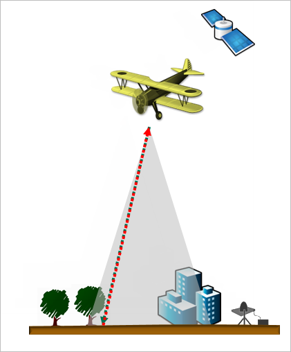
Lidar is a remote sensing technology that measures elevation by timing a burst of light energy (a laser pulse) as it travels to the ground and is reflected back to a sensor. The system is usually mounted in an airplane but can also be ground-based.

GPS is used to determine the horizontal coordinates of the elevation measurements. An inertial navigation system corrects for changes in the airplane's orientation to the ground.
Lidar systems collect extremely large numbers of measurements (called point clouds) from which detailed elevation models can be built. A single laser pulse can return multiple measurements if it passes through partially dense objects, such as vegetation, on its way to the ground. These returns can be classified into types of objects with post-processing software. Therefore, lidar can produce both ground elevation models and surface models that show trees, buildings, and roads.
For more information, see the ArcMap help topic What is lidar data?